


Chester Voting District, Choctaw County, Mississippi
About
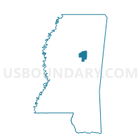
Outline

Summary
| Unique Area Identifier | 605186 |
| Name | Chester Voting District |
| County | Choctaw County |
| State | Mississippi |
| Area (square miles) | 33.81 |
| Land Area (square miles) | 33.73 |
| Water Area (square miles) | 0.09 |
| % of Land Area | 99.74 |
| % of Water Area | 0.26 |
| Latitude of the Internal Point | 33.35342650 |
| Longtitude of the Internal Point | -89.26750450 |
Maps


Graphs
Select a template below for downloading or customizing gragh for Chester Voting District, Choctaw County, Mississippi


Neighbors
Neighoring Voting District (by Name) Neighboring Voting District on the Map
- Byway Voting District, Choctaw County, MS
- District 5, Choctaw County, MS
- Fentress Voting District, Choctaw County, MS
- Kenego Voting District, Choctaw County, MS
- West Weir Voting District, Choctaw County, MS
Top 10 Neighboring County Subdivision (by Population) Neighboring County Subdivision on the Map
- District 5, Choctaw County, MS (1,874)
- District 1, Choctaw County, MS (1,628)
- District 3, Choctaw County, MS (1,579)